TECHNOLOGY
1.
Aviation Image processing station
The aerial photograph are taken from airplane with a determine proportion, then the Image workstation will process these images in the form of Raster which is taken through air film by way of photo scanning. On the basis of the photo controlling points the coordinates of which are determined on the field (at present utilizing the GPS technology) the processing stations proceed to process the photos, on the software specially made for use in aerial photos. The final products received aerial photos flat are modeled and transformed on the plane in a determined proportion, the photos being rectified about error caused in taking photograph. Besides on the station, the support for the work of establishing maps from aerial images by the method of rectification of drawing intra-operational and extra- operational mages is offered. The strong point is to help the cartographer to minimize the work of extra-operational surveying and to increase very much the productivity of map establishing. At present the Company is utilizing the process of image processing on the plane and the relief images processing station supplied by Intergraph film.
The equipments currently owned by the Company support the digital photo technology
|
|
Hardware
The Digital Image survey workstations: IMSZII, SSK Pro and SSK with the faculties as follows: Pentium III, 850 Mz 256 Mb (SSK 128 Mb), Monitor 28 inch, 36,4 GB or 18,2 GB hard disk drive. |
|
|
- Scanner with high dissociation degree:
+ SKAI - 2 dissociation degree 7m, 14, 21...
+ PS1 with dissociation 7,5mmm, 15, 21, 5,...
- Analysis survey machine.
- Photograph coordinate apparatus. |

|
|
- Computer workstations to edit map.
- A0 size printer
- Map correcting workstation Sun Spare
- Electronic map printing workstation Map setter.
- Large, multi-colored map offset printing machine
|
|
|
|
Software
- Digital Map Survey Software.
- Crowding software: Photo-T, Match-AT, and PAT-B
- DEM software: Match-T
- Map editing digitized software: Microstation, Mapping office, MGE...
- Photograph coordinate pin-prick machine
- Orthogonal rectifying software: Base Rectifier...
|
|
2. Map digitalization
Map digitalization is a technology of map establishment on an existing map body. The maps needing the scanning digitalization with dissociation are inserted into computer in the form of Raster Image. Raster map is inserted into specialized image processing software to be preliminarily rectified and to have the nucleus eliminated, then one uses an intelligent software for identifying some lines on the map in order to automatically turn them into the form of vector. Some indistinct lines, landmarks or improperly identified will be corrected by hand-made method. When the map is completely digitalized into vector, the map is carried out for calculation, rectified to the real coordinate, then it is edited according to the defined form. Presently, the company is utilizing the CESVEC technology and software.
3. Management conservation of the geodesy and map information
This is an enough new point in the management and conversation of the geodesy and map information. The technology is built on the basis of the information technology infrastructure of the company. Data are stored in a strong host computer and are consistent. The access to information for different projects will be fully satisfied and supported in data on the basic of the supporting making decision data managing software. It is convenient for the centers storing information and managing the map and geodesy data emitted from different forms, sources.
4. Plane control networks
During recent years, the Plane networks survey by the GPS technology has been enough popular in Vietnam because of its convenience, accuracy and its pre-eminent characteristics. Our company applies the technology to establish the co-ordinate networks. Following the class and the accuracy to apply the suitable technology. The company is using the fast, convenient, accurate and at low cost GPS technology for the state elevation co-ordinate networks at rank IV and up. For the remaining classes of the coordinate networks, the company uses the traditional survey technology, which is supported by the total electronic survey machines with high accuracy. For the processing of the co-ordinate networks, it is following the technology to utilize the appropriate adjusting calculation software. Presently, the US Trimble company of supplies to the company the CESAJ adjusting software with the networks under the forms of transmission lines and the data processing calculating software GPS (waves).
The company has in its possession the equipments supporting the establishment of the co-ordinate networks
- GPS static surveying instrument: 4000SE, 4000 SI (single frequency); 4000 SSE, 4000 SSI (dual frequency)
- GPS dynamic surveying instrument: 4600 LS (single frequency); 4800 LS, 4700 LS (dual frequency). The GPS dynamic surveying machines can survey the system of post-processing dynamic surveying and the system of real hour survey GPS-RIK. The quantity of GPS machines usable for the project is 5 sets.
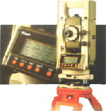
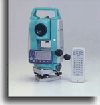
- Various kind of electronic total surveying machines with high accuracy supplied by famous firms in the world: TOPCON; SOKKIA; LEICA; NIKON
5.
Elevation networks
The Elevation networks are built according to rank, class and the degree of accuracy gradually decreased according to each rank, so the technology and equipment for building the Elevation networks of every rank are also changed. The State Elevation Networks 1st, 2nd class are used according to the traditional technology with the geometrical elevation surveying equipments supporting the technology machines of classes:
Levelling surveying I, II, III and IV:
- NI 004, N3, H1 (Surveying Level class I).
- NI 007, N2 (Surveying Level class II).
- NI 030, NI 025 surveying Level class III and IV, technical Level, Laser level machines for surveying class II.
6. Establishment of cadastral digital
maps
Cadastral map is a kind of special map, servicing the cadastre and land-managing branch. The cadastral map is built on the basis of cadastre's criteria, documents, norms, current regulations of the General Department of Land Administration (now Ministry of Natural Resource and Environment) and on the result of the field investigation and the technical equipment, modern survey technology in order to meet the following purposes
- Confirming the existing situation and representing the changes about boundary of land, administrative boundary.
- As basis for the land use planning, the planning of house construction and development, planning of the communication information, hydraulic works.
Technology process for establishing the Cadastral map establishment: investigation, preparation of documents, surveying equipments, determination of the land limit of the village following the document364/ CT (longitude and latitude of level 1 and 2, total surveying); determine nation of the land limit, piling the limit guide picket, establishment of the report on the limit of the plot of land, field investigation; detailed surveying, drawing the diagram, determination of principal works on the plot of land, and other landmarks ; transfer of the surveying data in the computer and processing in the computer, editing, processing, checking of the original extra operational drawing, joining of borders with the same scale and different scales, correction, printing of the technical dossier of the plot of land, printing of the report of limit, editing the Cadastral map following the administrative land limit ; official printing of the original map and various kind of related dossier.
7. Establishment of the digital topogpraphical
body
Previously, when the information technology is not yet developed, the establishment of map on paper for analyzing and assessing the natural, economic and social phenomena was a work enough complicated and waste of time, but today, with the fast development of the information technology and the support of the specialized software, the solution of the problems on analysis, general assessment as well as forecast, prevention is not the a complicated matter. The information technology may calculate the time in minutes, even in seconds and bringing to leaders the accurate answers on the matters related to the management business in which they are interested. However, in order to get an information system in efficient service to the management business, it requires to invest for construction step by step according to an appropriate system and one cant be very impatient.
The first important thing when starting building any Geographic Information System (GIS), is to have an adequate and accurate to topographical based digital data on the basis of this basic data, to proceed to accumulate the natural, economic and social information in service of the management according to the determined system design, and from that to bring into the solution of the concrete problems of the management.
|