OUR COMPANY'S PRODUCTS
|
 |
|
Cadastral
maps
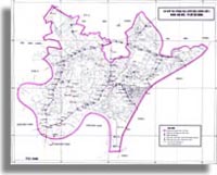
| The cadastral map is edited and plotted from the basic cadastral map according to every administrative unit at the village level, surveyed in supplement to the whole plot of land,the type of land of each plot of land is determined in accordance |
|
|
|
with the statistic requirements of each land user in every piece of map, the cadastral map is well made to be appropriate to the data in the cadastral dossier.
The cadastral map represents the position, the shape, the area, the number of the plot and the type of land of each plot according to every user, meeting the requirements in the State land management at village, district, province and central levels
When establishing the Cadastral map, to unanimously utilize the coordinate framework network, the State-elevation networks. At present, we are utilizing the coordinate system VN 2000. Ellipsoidal WGS-84, the plane coordinate system UTM. The axle longitude is specially determined by the General Department of Cadastre (the Ministry of Natural Resources and Environment now) for each province. The zero point of the altitude of the base altitude point at HonDau-Haiphong city
Utility of the Cadastral map :
 As the basis for land assignment, land registration, land withdrawal, issuance of the certificate of the right of land use in general and the certificate of the dwelling house ownership and the right of land use in the urban area in particular.
Confirmation of the actual situation of the administrative land limit at village, district, province levels.
Confirmation of the actual situation, the representation of the change of different categories of land in each administrative unit at village level.
As the basis for the planning, the establishment of the land use, the planning of construction of inhabitant zones, roads of communication, the water supply and drainage, the design of civil works as basis of surveying of the underground works.
As the basis for the inspection of the situation of land use and the settlement of the land dispute.
|
 |
|
Topographical
map
| The topographical map is the reduced drawing in the topographical landmark froms on surface on the paper according to a mathematical rule and a fixed scale on the basis of the field surveying data associated with the work inside the room. |
|
| |
Following the scale and the purpose of the utilization of the map, one may cut down, summarize on add some topographical landmark elements.
The elements of content of the topographical map are divided in 7 groups of class following 7 special subjects namely: Basis of mathematic, water system, topography, population, communication, border line and vegetation. The element in one group of classes are drawn in a separated file. In a group of classes the elements of content are arranged again per class. The basis of the separation in groups of classes and classes are the regulations on the content of the topographical map in the Symbol of the topographical maps of scales: 1:500, 1:1000, 1:2000 and 1: 5000 promulgated in 1995
The element of content of the maps belonging to different groups of classes are drawn in different files. The main content of the groups of classes is stipulated as follows:
The group of classes: Basis of mathematics includes the map frame, the kilometric grid; the geodesic controls, the explanation, presentation out of frame and the related contents.
The group of class: population includes the content of inhabitants and the economical, cultural, social objects.
The group of class: topography includes the factors of the land shape, land nature and the altitude points.
The group of class: water system includes the hydrographic factors and the related objects.
The group of class: communication includes the traffic factors and the development equipments.
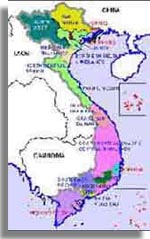
The group of class: Bonder line includes the boundary line, the boundary landmark, the administrative land limit al various levels; the limit of the restricted area, the limit of land use.
|
 |
|
Special
subject map
| Map of the actual situation of land use: the map is clearly represented in the actual situation of land use in different provinces, cities, it is a valuable data in service of the purpose of the province in management, planning investigation, planning map.
The map is clearly represented in the actual situation of the planning of land use in different provinces, cities, in service of the work of management, investigation. The map is digitalized, rectified, generalized,ect to be appropriate to every condition of province and the city. The map is printed with high quality.
|
|
| |